


Petralogix performed hydrographic survey worked on the Delta Mendota Canal to conduct in order to observe and identify areas along the canal that were in need of further assessment and potential repair.
Petralogix performed sedimentation and bathymetry investigations to verify potential pipeline alignment hazards for water intake pipelines along critical infrastructure project routes.
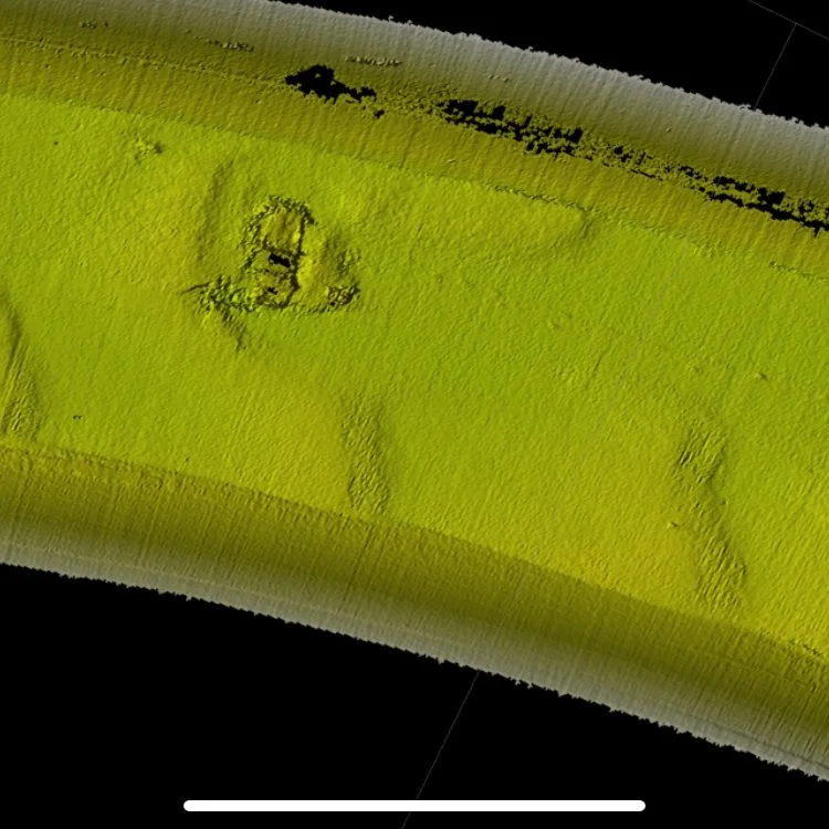
Petralogix was able to map and find a lost (submerged) vehicle within the greater San Joaquin Region waterways. High resolution MBES systems were used to map and locate a variety of objects on this project.
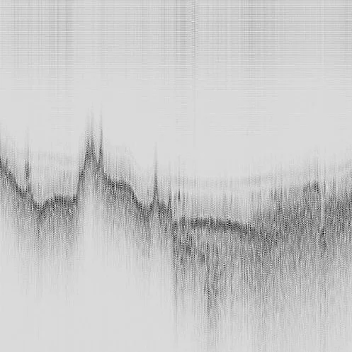
Petralogix performed sub-bottom mapping surfaces to identify trace features such as subsurface faulting, rock layering and sediment buildup for a geological hazard assessment.
Petralogix performs ongoing hydrographic surveying services to engineering, architectural, and government industry clients. On this project we performed geologic mapping services for engineering design recommendations.